Wednesday, February 1

Equipment Focus - Ghost SL 40

Nearly impervious to weather, the Ghost™ SL is designed for Arctic, Himalayan, and Antarctic expeditions. It is our most hardcore, cold temperature bag. Mountain Hardwear’s exclusive welded-baffle construction and moisture shedding Conduit™ SL shell aid insulation and wind resistance. Ghost’s roomy cut provides room for dressing / undressing, or for extra comfort when you’re waiting out a storm at base camp.

Equipment Focus - Millet/OneSport Everest

For the 6,000-8840m range

The Everest is the benchmark for high-altitude disciplines.
It has trodden the fourteen 8,000+ metre peaks, the Seven Summits and the two poles, and today equips the vast majority of expeditions to the Himalayas. New materials, such as GORE-TEX® Top Dry, have made it 10% lighter, and it achieves isothermal performance down to -60°C.


Description
- High-performance upper, insulating, waterproof, and very resistant to abrasion.
- Removable inner slipper in insulating aluminised alveolite.
- Microcellular midsole increases insulation.
- Carbon and Kevlar® inner rigidity reinforcements.

Equipment Focus - Bask Expediton suit


Very warm down overall for extreme conditions during polar expeditions and high altitude Alpine climbing. The salopettes are very lightweight and take up little space. Thanks to "closed warm seam" technology it will protect you against extreme frost (-35°C).


Anatomical shaping of the knee patch and elbow area
Uses "Closed warm seam" technology
Big warm hood with tunnel, can be easily adjusted with elastic cord , cordlocks and a Velcro flap
Front, back and side zippers are insulated with inner flaps and closed with outer Velcro flaps
Elastic, adjustable suspenders inside the saloppettes
Cuffs are made of Polartec® fabric
Cuff volume is adjusted by Velcro flaps
Hooks on the sleeves for fastening gloves
Two capacious outer pockets are covered with Velcro flaps
"Warm" chest pocket with zipper
Two inner pockets with zippers
Single zipper runs along the full length of the pants and around the rear, allowing you to adjust ventilation and to detach the back flap
Front zipper with two sliders can be opened both from the top and bottom
Snow gaiters at the bottom
Knee area and bottom part of the pants are reinforced with durable fabric

Peglers.co.uk

Click on this link above to see Dave Peglers company - If he did not have it in stock he got it for me. His service and that of his colleagues was fantastic!


Equipment - Other

Sleep:
Mountain Hardware - Ghost SL 40
Snowline Mountain Equip sleeping bag

Navigation:
Gromit

Vision:
Cebe OTG Edge - Cat. S3
Adidas Evil eye Elevation climacool

Electronic:
Leica Binoculars
Canon Camera & Lens & Charger
Sony camcorder & charger
Video tapes
Polar watch
Camera bag
Summit camera Sony cybershot W100
Satellite phone & charger & battery
Solar Charger

Equipment - Upper body

PHD - Mustagh Down Jacket
Arc'teryx Men’s Alpha SV Jacket
Wild Things Insulated jacket
Icebreaker Bodyfit260 Slalom shirt Zip alloy/mars L
Mountain Equipment Fleece jacket
Mountain Equipment blue base layer top
Mountain Equipment Coop orange base layer top
Expedition weight thermal shirt MH powerstretch top

Equipment - Lower Body

Icebreaker Bodyfit260 Bodyfit260 Strider black/charcoal L
Expedition weight thermal trousers MH powerstretch tights
Trekking trousers
North Face fleece longs
Mountain Equipment Coop blue base layer longs
Moonstone Shell outer trousers

Equipment - Hands & Head

Soft base layer Gloves
Mountain HW Mountain Mitt
Black diamond ice glove
Beanie hats

Equipment - Feet

Millet One Sport Everest
Raichle - Approach boots
Teva's
Smartwool Socks - Mountaineer
Smartwool Socks - Liner
Coolmax liners socks
Hiking socks
Laces

Equipment - Climb

Respro Sportsta Mask
Osprey Crescent 85 backpack
Crampons
DMM Harness
Life adventure flask
Black Diamond Raven Pro ice axe
Leki poles
Petzl MYOBELT XP head torch
Petzl - Ascender
Grivel Ice tools
Belay device, carabiner, sling
Bask expedition suit

Equipment - Camps

Exped down mattress 9
Thermarest - original
Black Mug
Jetboil stove
MSR Windpro stove
Water bottles - Nalgene
MSR Titan™ 2-Liter Pot
Titan™ Kettle
Head torch - tent Petzl tikka
Base camp tent
Mountain tents
Victorinox knife

Sunday, January 1

Proposed Camps

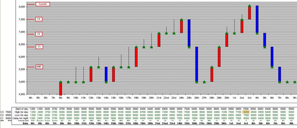
Although I'm going to be independent, I have undertaken a fair amount of research regarding the possibilities of where my camps will be. The picture shoes the latest scenario that I have produced (yes in MS Excel). Many factors will determine this, probably the most important being the weather, but it is important for me to have the correct equipment (tent, food, stove etc) at the right place at the right time. I will also be discussing this further with Jamie once we are at ABC. Due to us having to acclimatise there will be plenty of time for us to chat...

The red bars indicate an ascent with a camp at a higher altitude than the previous night. Camps are demarcated by green triangles. Black lines indicate that a climb occurred to a higher altitude but that I returned to the altitude of the previous nights camp. Blue bars are the opposite of the red bars - going down rather than up.

You might notice that there is a camp at/on the summit - I would like to sleep at 8,000m if I can. This will be a practise run for a high camp on Everest (similar to the South Col). This is a bonus objective and critically depends on how I feel and what the weather forecast is.

Shisha - photo Mike Teger

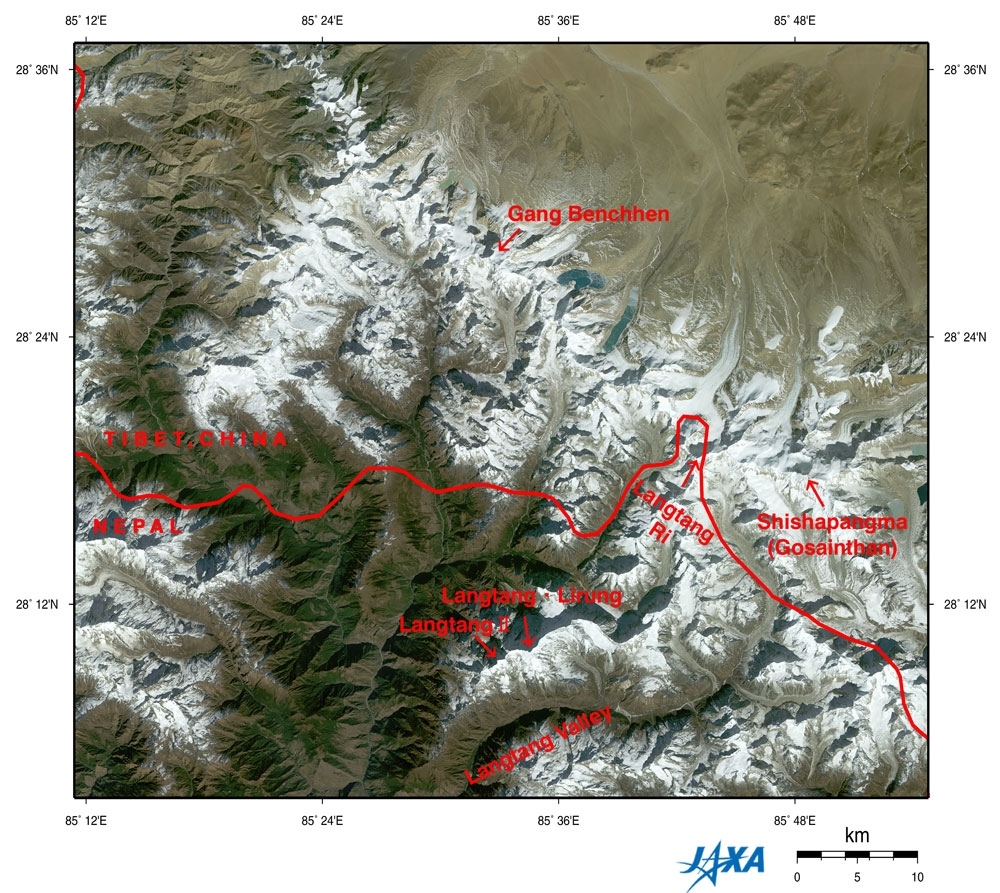
Advanced Earth Observing Satellite (ADEOS)

Figure depicts the Shishapangma (also known as Gosainthan) and Langtang Mountains in the Himalayas observed by AVNIR. The white sections are mountainous areas covered with snow. The steep mountains seem to cast their own shadows on the tops and the ridges, upper left. This is because the observation time was before noon local time as the sun shone from the lower right.

Nepal is in the lower portion of the figure, and Tibet, China, is in the upper portion, with the complicated border lying in an east-west direction. Shishapangma is on the right of the figure, 8,012 m above sea level on the Tibetan side. You can see other seven-thousand-meter peaks, including Langtang Ri (7,239 m above sea level), Gang Benchhen (7,211 m above sea level), and Langtang Lirung (7,245 m above e sea level). Some glaciers can be seen in the center of the figure near the bottom of Langtang Valley on the Nepal side. Many glaciers line up in the northwestern area around Shishapangma on the Tibetan side. Some glaciers on the Tibetan side have glacial lakes downstream that look copper green or pale emerald green.

The growth and melting of glaciers are considered indices of global warming, and some reports say that glaciers are easily affected by global warming in places at relatively low latitudes and high altitudes, as in the Himalayas and Tibet. As glaciers retreat and contract, glacial lakes collapse, flooding downstream areas and causing a rise in sea level. For this reason, we have to continue careful observation. Valley bottoms less than 1,500 m above sea level (lower left) appear veiled. This could indicate air pollution in the Katmandu basin. The mountainous area and Tibetan Plateau (higher than 3,000 m above sea level) look clear because the thin atmosphere has little influence on visibility.
Greenish brown: Forests
Yellow ocher, brown or gray: Exposed rocks or deserts
Brownish gray or bluish gray : Glaciers
White: snow or ice
Greenish blue or pale emerald green: Glacial lakes
Source: http://www.eorc.jaxa.jp/en/imgdata/topics/2005/tp050719.html

The Plan

Choose between Cho Oyu, 8,201 metres (26,906 feet) and Shishapangma 8,013 metres (26,289 feet). The idea is to be on a mountain, that if I’m feeling good, will present the opportunity to go higher. Who knows, perhaps my body (and mind) might not want to go above 7,000m? But to attempt another 7,000m and find I’m strong with no where else (up) to go, does not seem to be an option to me. I was very interested in Cho Oyu and in fact would have liked to have included a trek (over the Nangpa La pass) from Nepal to its base camp. But that route is still not open and its rumoured that one would be arrested by the Chinese. Jamie (see below) was influencial in me choosing Shisha.

I don’t want to be flown up by helicopter…I want to climb up by myself, just me. It’s not an option to throw a lot of cash at the problem and recreate a “safer” and “easier” route up. Might as well not do it at all, or for that matter might as well watch the Everest Imax movie...
Therefore no Sherpa support on the mountain and no oxygen will be used!
I intend to carry all my camp requirements and build them along the way. I will be using yaks to get my gear from BC to ABC.

I have base camp (BC) and advanced base camp (ABC) infrastructure – mainly food and access to technology. This will be provided by Jamie McGuinness company, Project Himalaya. I did investigate other companies, but immediately felt comfortable with Jamies responses about the level of service he provided. I look forward to meeting him as I feel we will get along well. He will also be organising the infrastructure regarding climbing permits and Chinese permits, transport to BC etc… Something I would like to have potentially done but unfortunately rather difficult while sitting in The Hague. Jamie also offered more free Burger King vouchers for the Base camp outlet than other companies did.

Questions the trip will answer

  • Do I have the organisational skills?
  • Do I have the physical ability to get to & above 8,000m?
  • Is it really all worth it?
  • Is it possible to build a camp infrastructure on my own?
  • What are the affects of the climb on heart rate?
  • Will I be affected by AMS?
  • What rate of ascent is feasible?
  • Is Mount Everest a possibility?
  • Am I able to climb to 8,000m without oxygen?
  • Am I able to climb to 8000, without Sherpa support?

Objectives of 8000m and above

To:

  • Go high
  • Experience the freedom of the hills
  • See the curvature of the earth from land
  • Get to an 8000m summit
  • Sleep above 8000m
  • “Enjoy life” as Mallory said
  • “Dare Mighty Things” as Theodore Roosevelt said

Monday, August 1

August 2005 - Moraine training


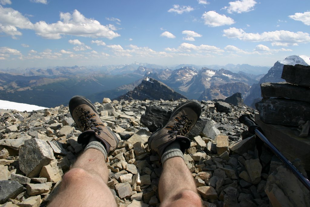
Whenever I'm out in the hills I have an expression that "today I'm training for tomorrow" even though the event is an objective in it's own right . Storm Mountain was one of those days. A climb on the border of BC and Alberta in Canada, from 1,600m to 3,120m consisting mainly of scree slopes, but with spectacular views. This is likely to be good experience for the morraine slopes from base camp (BC) to advanced base camp (ABC) on Shisha.

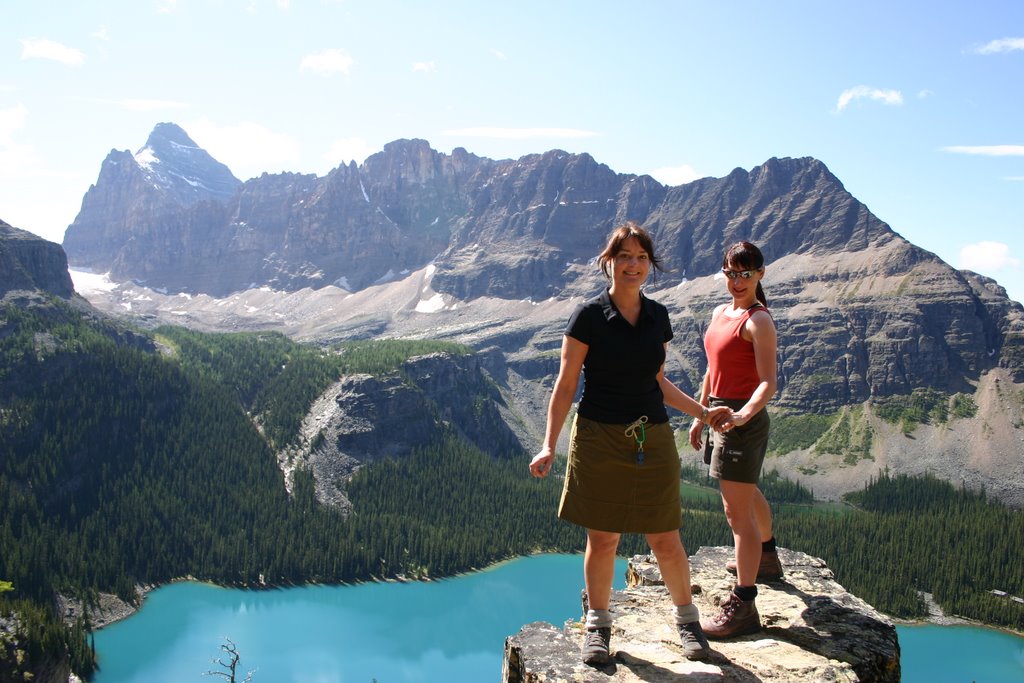
On the same trip, how is this shot of Claire & Lynnie at Lake Ohara

Saturday, January 1

December 2005 - Lake Ennerdale in Winter

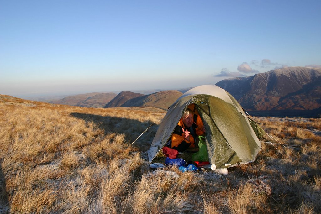
Two trips occurred in December. The first was with Raymond E in the Lake District. I have a hike around Ennerdale Water (54 31.516N,3 23.546W, if you have not Googled Earth'd yet, you have to!) in the Lake District which has provided a great training ground for testing kit, navigation and physical capabilities. At the apex, it is also possible to include Scarfel Pike and hence the trip can be up to 3 or 4 days in length. It is mostly deserted and offers a great variety of peaks, valleys, ridges and of course stunning views of the lakes (incl. Buttermere). It was bitterly cold being the middle of winter and even though we had clear skies, it was quite a shock for Raymond having just arrived for the warm Cape!

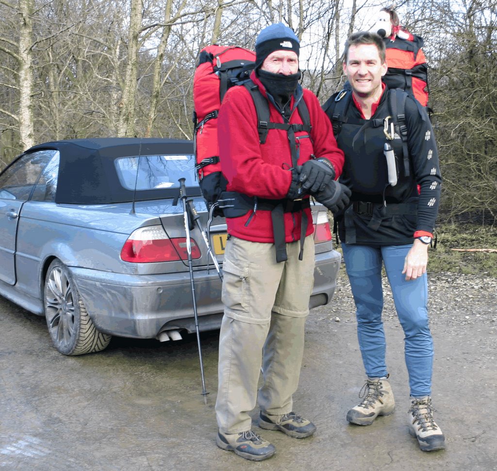
The second trip (1 night) was in the Peak district and only a couple of days later. I had some extra energy to burn off, so Raymond and Dave drove me to Edale (beginning of the Pennine Way). I was rearranging my kit after they had dropped me off when I noticed that I was missing my tent poles. My objective was to do some GPS navigating, so I just decided to walk all night instead of pitching a camp. But as I got further into the walk (and it was already early evening) the weather really got bad. I could only see about 3 feet and for anyone who has been to the peak district, this does not help much due to the undulating terrain. The dense mist just defused my head torches beam. Anyway I stuck to my guns and in complete faith just followed my GPS readings. Not the easiest to have added due to the pouring rain and wet map. A good couple of lessons – get Gromit to check the equipment and it was fabulous GPS training. Believe in the technology – it’s not wrong.

Monday, July 1

July 2002 - 4 Peaks challenge


So we are having dinner and Carol says one of the teams is short of a member! This for the Wooden Spoon Society's 4 Peaks challenge. Now although in a couple of weeks, I had had a "couple" of beers, so next thing I know is that I had volunteered to join.


Then I got the letter:
I am very excited to be part of a team, the ‘Cobalt Cougars’, in this year’s sponsored Wooden Spoon Society Vauxhall Four Peaks Challenge.
Wooden Spoon Society is the charity of British Rugby founded in 1983 to help those disadvantaged by physical disability, and social and mental deprivation – particularly children.

The Four Peaks Challenge – What is it really?
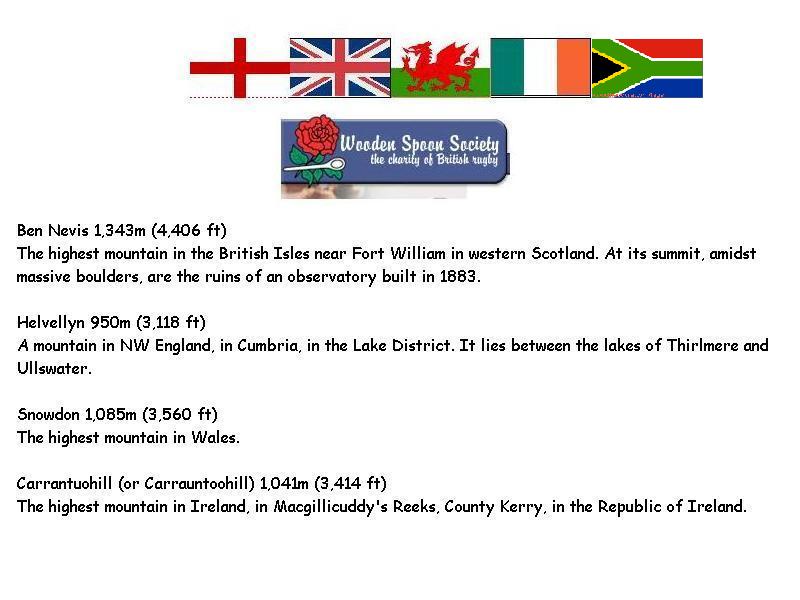
The team is 3 climbers and a driver. The 3 climbers each have to climb:

Ben Nevis, Scotland, 2pm 4th July
Helvellyn, Lake District, England, 6am 5th July
Snowdon, Wales 3pm 5th July
Carantouhill, S.W Ireland 7.30am 6th July

Or another way to put it –

Climb up and down 14,000ft. of mountain and drive 1900 miles in less than 48 hours. As you can imagine, we are in serious training!
There is a limit of 50 teams, and each team must raise a minimum of £3,500, and our objective is to exceed this significantly. The Wooden Spoon Four Peaks Challenge is an established event and very well supported by Challenge Sponsors ranging from Vauxhall who provide vehicles, Groupama who insure them, to Guinness who refresh us after Carantouhill – so all the money we raise goes to the charity.


....Oops...."serious taining" would probably have to occur en-route


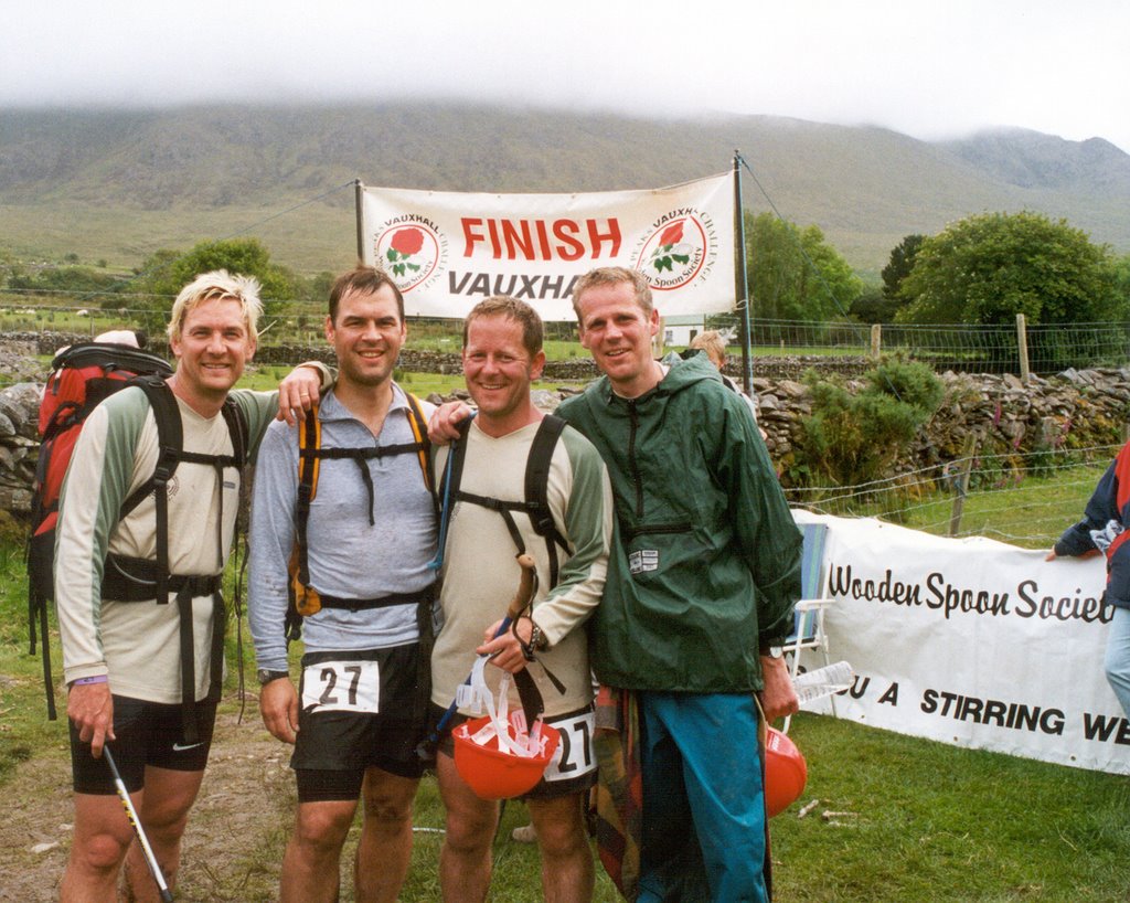
But it was great fun, somehow we all ran most of the way, did not sleep much and finaly got to the end...


My hair still had the remains of my Marshall Mathers impression from 27 April


1. Ben Nevis - 3h30
2. Helvellyn - 1h40
3. Snowdon - 2h18
4. Carrantouhill - 3h05